Total Escape is California, off the beaten path
spring wildflowers + snowBefore the age of digital cameras, traditional cameras had a view port called a 'view finder' - which has been eliminated with digital models. Now you look at a screen to determine your image framing. But outdoors, in the bright sunlight, this small screen is nearly impossible to see the details with all the glare, so you end up shooting blindly in the direction you aim for. Sometimes you get surprises when finally viewing your large images on a computer.
That is what happens when I photograph wildlife. I end up seeing additional animals or birds in the frame that I didn't see initially in the field. Earlier this week, as I sat down quietly on the side of the meadow and within minutes, a bald eagle came down to the ground 50 feet from me. I frantically tried to turn my camera on and captured the giant bird as it flew away.

This Total Escape website is DanaMite's creation for California outdoor travels. An independent guide to the back roads of California and a massive small town directory. A labor of love, updated monthly, over two dozen years - and it needs your support to stay alive and online.
#totalescape
Winter snow is still in the mountains above 4000' elevation! Carry snow chains when traveling anywhere above 2000' elevation in California.Traveling the rural regions? Check your driving route / road conditions and always have a plan B.
Google Maps is not broken: Always be flexible in your itinerary and do not count on cell phone reception in rural regions. Plan your trip and any side routes in advance - and always carry paper maps!!

all local: updated monthly
ancient: 27 years online!We're still here, thousands of pages and decades later. Way outside the city limits, beyond the county line. No wifi, no smart meters, no gaming addictions, no traffic lights, no city noise. Rural living in California still exist. Hike on the weekends, bike to work, boating mid-week, we have you covered for destinations. Find a new boulder garden, a big waterfall, trailhead or an ancient lava cave. Total Escape - Two whole decades online. Not quite obsolete.
Craving the Wild? Before the tweets, the constant memes and paralysis of our current culture, DanaMite started this travel web site way back in 1996. Catchy phrases like, FOMO (Fear of Missing Out) did not yet exist.
Total Escape features abundant real photos of real places. Secluded destinations, camping and lodging, examining the best back roads, side routes, the topo maps (to get you out there). Locals-only travel tips, gear reviews, festivals and events. This unique travel site is updated every month, for more than the past 2 decades!
Juicy content specific only to California. Focusing on outdoor destinations, small towns and budget-minded travel since 1996, we've recreated the weekend getaway - without the crowds. Escape the matrix, the city life, the traffic jams and learn how to avoid the tourist traps. Drive on past the factory outlet malls and the water slides, we've got much more to show you. Way out there, on the back roads, and in the backcountry.
Wilderness in California - more nature, less people.
hike. bike. camp. kayak.
Site Founder
camp diva DanaMite

About
archives, online history

Local Road Trips
guided camping tours

California A-Z
small towns, rural calif

Explore the Site
Lodging
historic inns, lodges, indie motels
Recreation
outdoor activities, leisure, tours
Journey
travel tips, scenic drives, weather, roads
Destinations
back roads, small towns, wilderness
Gear Shop
outdoor equipment, tools, survival
Map Store
state atlas, camping maps topographic
Social Links
find us on social media, on occasion
Outside
blog articles, outdoors in california
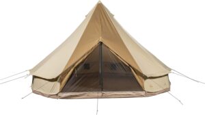
shop all tents

|
|
|
|
|
|
|
|
|
|
|
|
|
|
|
|
|
|
|
|

|

|

|

|

|

|

|
Total Escape has been an Amazon Associate for over 20 years! Earnings from your purchases keeps this site alive.